Wednesday, 9 May 2012

Tuesday 20th March


Today had a lot more people join us. As well as Edith and myself several sixth formers from Lewis School attended the session along with other members of the local community. We began by showing the new volunteers some of the already recorded archaeology, explaining the ring cairns and the cist graves. Following this we moved out in a long line sweeping the area all the way back towards the car park. As there were more of us today we decided to cover the area behind the Ordinance Survey trig point as well, walking all the way round and finishing back to car park. There were a few interesting features spotted along the way but all of those turned out to be natural.


After lunch however, one of our volunteers who frequently walks this landscape guided us to another stone he’d spied whilst on his walks. This turned out to be a lot more promising!  What appear to be three circular cup marks all above a long semi-circular groove carved into the surface of a rock.  Another small circular cupmark lay to the left of these markings. Allin all, a very fascinating day!

We are working Wednesday, Thursday and Friday this week and one day at the weekend that has yet to be arranged.

Wednesday 21st March

Wednesday’s survey began with the weather on our side for a change! Much sunnier and warmer we managed to walk the long sections to the east of the common and all around the back finishing on the west side. There were plenty of rocks to inspect but none of them were harbouring our sought-after rock art. 


 We did however, have an extended trek over the common to investigate a stone noticed on a previous walk by a volunteer. The large stone appeared to be inscribed with the letters ‘DUW’ the Welsh for God which makes this very interesting-according to locals there is allegedly another stone on the other side of the Valley inscribed with the word for Satan. For what reason we’re not currently sure of but it will make for some fascinating research!


Thursday 22nd March

Another bright and breezy day on Gelligaer Common! Small turn out today but we set out for the western edge of the project area walking from the road to halfway down the contour of the hill. It was decided that we leave the steeper, lower section as it would pose a concern for health and safety.

  
During this section of our walkover another stone was noticed that could be showing a very eroded example of rock art however we will have to ask for a second opinion, as it’s very unclear. No one in the group could agree exactly on what they were looking at! The last section of this part of the study area will be walked tomorrow, hopefully we’ll have another interesting find!


Friday 23rd March

Another glorious day on Gelligaer Common! A few more people gathered today keen to finish off our original survey area. We covered all the remaining ground set out in the original project plan by lunchtime, which was fantastic! We even had time to show our volunteers the cup mark
Janine found last summer.


After lunch we expanded our area by beginning to walk over the area the other side of the road south of the car park. We didn’t spot any prehistoric rock art today but we did come across some markings that initially got me very excited (as it was me that spotted them!) that turned out to be mostly likely a trig-point carving. It was carved into a flat stone by the side of the north-south road, not quite what we were looking for but interesting none the less!


Thursday, 22 March 2012

Tuesday 20th March


Today had a lot more people join us. As well as Edith and myself several sixth formers from Lewis School attended the session along with other members of the local community. We began by showing the new volunteers some of the already recorded archaeology, explaining about the ring cairns and the cist graves. Following this we moved out in a long line sweeping the area all the way back towards the car park.  As there were more of us we decided to cover the area behind the Ordinance Survey trig point as well, walking all the way round and finishing back to car park. There were a few interesting features spotted along the way but all of those turned out to be natural.

After lunch however, one of our volunteers who frequently walks this landscape guided us to another stone he’d spied whilst on his walks. This turned out to be a lot more promising! What appear to be three circular cup marks all above a long semi-circular groove carved into the surface of a rock. Another small circular cupmark lay to the left of these markings. All in all, a very fascinating day!
Small cup mark (just visible to the left of the coin)
We are working Wednesday, Thursday and Friday this week and one day at the weekend that has yet to be arranged.

Natasha Scullion

Friday 16th March


Only three of us again, Ken Janine and me. It was quite clear, but very cold. We got a lot done - all the area to the west of where we were working yesterday, as far west the cup-marked stone that was found in the summer and the westernmost platform house, and then round the north side of Pen Garnbugail as far as the track to Cwm Bargoed. There are more crags here, so we were able to see that most of the stones standing on end were like that because they had broken off the crags and bounced down the hillside until they came to a stop. So the ‘standing stones’ on the hillsides probably all got there naturally and aren’t man-made at all.

We made a proper record of the cup-marked stone, which we hadn’t been able to do in the summer as we had no measuring equipment then. We still haven’t found any more of them though!

Dr Edith Evans

Thursday 15th March


"Is there any archaeology out there?"
A very good turn-out - there were seven of us: Ken, Clive, Graham, Malcolm, Nicola, Judith and me. The only problem was the fog. It was so thick when we got to the car park at 10 o’clock that we had to wait about three-quarters of an hour for it to lift enough for us start work. While we were waiting we went to look for the big cairn by the road junction that we hadn’t visited on Monday. It took us long enough to find that too. We discussed whether it was really a ring cairn, or whether it was a round cairn that had been badly robbed, perhaps to surface the road at some time, but you can’t tell be looking at the surface.

After that we thought that the fog had thinned sufficiently to go looking for cupmarks, so we searched the little valley to the west of Carn Penbugail, where the ring cairn with the slabs set on edge is located, as we wouldn’t get lost there. Mind you, when we got up to its north end the fog was still thick enough that the two people on the far ends of the line couldn’t see each other. When we had done the return transect, we decided to look on the south side of the road as it was much clearer there. We found three stones set on end, which we thought might be the sort of little standing stone that you sometimes find associated with a group of cairns. 

Dr. Edith Evans

Wednesday 14th March


No fieldwork today!

Tuesday 13th March


Only Janine, Natasha and I were able to make it today, so we started the survey with quite a lot of time working out what was going to be the most effective way of ensuring that we leave no stone unvisited! 

My first idea was to mark the four corners of a 100m or 200m square out with GPS and then go over it carefully. A 200m square turned out to be too big because we couldn’t see the corner markings well enough, especially with only three of us available. So we tried a 100m square, working from a base line and moving 20m at a time, measured by the GPS. Then we decided that we might as well keep going and walk much longer transect guided by the GPS. That seemed to be going splendidly for most of the morning, provided we managed to walk on the line set by the GPS. But then in the afternoon we discovered that the reason that we were finding it difficult to walk straight wasn’t anything to do with us - the GPS was jumping about six or eight metres at a time, and we were covering some areas two or three times! 

So we concluded that the only realistic way we were going to be able to do it was to orient ourselves by the topography. But we did manage to cover a swathe to the north of the road that runs east-west under Carn Penbugail, on its way to Bedlinog.

Dr. Edith Evans

Monday 12th March

This was our first day’s work, following an initial meeting last week at Lewis School Pengam. 
First of all we went to look at Maen Cattwg, just outside Gelligaer village. This is one of the few cup-marked stones known already in Glamorgan, and definitely the best. 

Initial meeting at Lewis School Pengam
Archaeologists from the Royal Commission on Ancient and Historic Monument in Wales counted 40 cup-marks when they surveyed in 1960 for the Glamorgan Inventory. Some of them are quite deep, but others are very faint. At least some of them have become shallower than they were originally, because flakes of the sandstone that make up Maen Cattwg have broken off through weathering.

We then went up onto the common to look at the Bronze Age cairns on and around its highest point, Pen Garnbugail, and also to see last summer’s cup-marked stone. This has only one cup-mark.
Having got all the background, we will start on the proper survey work tomorrow. Hopefully, the weather will be as nice as today!

Gelligaer Rock Art Project

Following the exciting discovery last summer on Gelligaer Common of a piece of prehistoric art - a cup-marked stone, the Glamorgan-Gwent Archaeological Trust and Groundwork Caerphilly decided that it would be a good idea if we looked to see if there are any more. We have been lucky enough to get funding from Cadw for archaeologists from the Trust to help local residents carry out a survey on the common with the specific aim of looking for cup-marked stones. 


Some people have told us that they already know of some there, but we need to photograph and describe them and put them on maps. We are also trying to find out more about a cup-marked stone, called the Marrying Stone, found in 1935 in Bargoed.

Keep returning to these pages over the next few days to find out all about this exciting project and the discoveries we make.

LOST AT BARGOED!


In 1949, the archaeologist Lady (Aileen) Fox, the wife of Sir Cyril Fox who was the Director of the National Museum of Wales, wrote a letter (probably to OGS Crawford, the head of the archaeological division in the Ordnance Survey). In it, she mentioned a cup-marked stone that had been found in an allotment in Bargoed, and was known locally as ‘The Marrying Stone’.

Cup-marked stones were created during the Neolithic, or New Stone Age (roughly 4400 - 2300 BC). Using pointed stone tools, Neolithic people dug out circular depressions a couple of inches across on rocks that were softer than the tools. There might be just one cup-mark or there might be a group of several of them. The rocks might be natural outcrops or they might have been moved by humans, perhaps to become standing stones. Cup-marks are the commonest rock art motifs found in prehistoric Britain. Although rock art is common in some parts of Britain, such as North-east England, it is very rare in Wales. However, one cup-marked stone, called Maen Cattwg, can be seen near a footpath in fields just outside Gelligaer village.

Maen Cattwg cup marked stone
 And in the summer of 2011, another cup-marked stone was found on Gelligaer Common. Learn all about this find.


Above is all the information we have at the moment about the Marrying Stone. It was written down on an index card by an archaeologist called Norman Quinnell who worked for the Ordnance Survey and was responsible for carrying out an archaeological survey of South Wales in the 1950s. His writing is not very easy to read so we have added a transcription. None of the people he asked when he visited Bargoed knew anything about it. Do you?

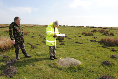
We don’t even have a clear idea about what it looked like, although when Lady Fox saw it, it had cement around the top suggesting that it had been built into a wall. It could just have been a chunk of stone with cupmarks. Or it could have been a large rock the one in the photos, with one or more cupmarks on it.

The stone was found nearly 80 years ago, so anyone still alive who was around then was most probably a child at the time. Or there might be people who have been told about it by their parents or grandparents. The name ‘The Marrying Stone’ suggests that there might have been traditions about it connected with weddings. Have you heard any of these?

If you have any information, can you contact Janine Reed at Groundwork Caerphilly (tel 01495 233160, email Janine.Reed@groundwork.org.uk) or Edith Evans at the Glamorgan-Gwent Archaeological Trust (tel 01792-634227, email edith@ggat.org.uk)